Buying On Mason Island: Docks, Flood Zones And Access
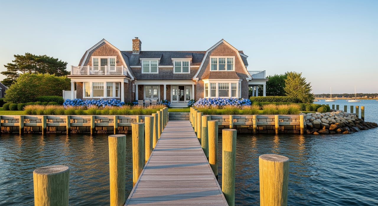
What draws you to Mason’s Island might be the quiet coves, the quick boat ride to open water, or the sense of privacy minutes from downtown Mystic. Buying on a coastal island also means a few extra boxes to check before you fall in love with a view. You want clarity on docks, flood zones, and how access works so there are no surprises at closing. This guide walks you through the key steps, who to call, and what paperwork to collect, all focused on 06355 and the Town of Stonington. Let’s dive in.
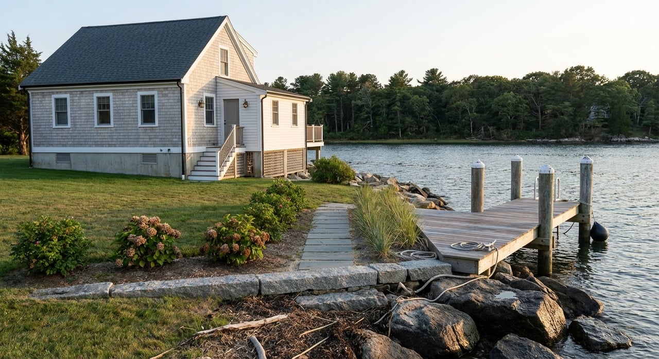
Mason’s Island sits at the mouth of the Mystic River in Stonington, linked to the mainland by a causeway. The northern end is more public facing with marinas, while the southern half is gated with private roads and community controls. Expect a gate at the main entrance to the southern section and confirm the exact access arrangement for any parcel you consider. For a quick background on the island’s layout and history, review the neutral overview on Mason’s Island.
Parts of the island have private roads that are maintained through local associations. Before you tour, confirm whether a property is behind the gate, which roads are private, and if any easements are recorded for access or utilities. If a home is landlocked behind a gate, understand the procedures for guest access, deliveries, and contractors.
Much of Mason’s Island is governed through recorded deed restrictions and private organizations, including the Masons Island Company, the Mason’s Island Property Owners Association (MIPOA), and the Mason’s Island Fire District (MIFD). MIPOA maintains rules, an Architectural Review Committee, and standards that guide construction and property changes. Review current committees and governance resources on the MIPOA site. Plan time to read any covenants, architectural guidelines, signage rules, and road work ordinances that may affect your plans.
Water access is the dream, but the rules are real. In Connecticut, most work waterward of the Coastal Jurisdiction Line is regulated at the state and often federal level. Your goal is to verify that any existing dock, float, or seawall is legal and that your future plans are feasible.
Connecticut’s Department of Energy and Environmental Protection (DEEP) regulates structures like docks, pilings, floats, seawalls, dredging, and mooring fields. Many routine activities can use DEEP general permits, while larger or unique projects need an individual permit. Review DEEP’s overview of categories on the General Permits fact sheet. The core statute for in‑water work is Connecticut General Statutes §22a‑361.
The U.S. Army Corps of Engineers (USACE) also oversees certain activities. Many projects rely on USACE general permits, but some require individual authorization. If a prior owner made changes without approvals, you may face remediation or retroactive permitting. Build in time to confirm permit history with DEEP and, if needed, the Corps.
Moorings within Mystic Harbor are managed at the town level. Stonington’s Mystic Harbor Management Commission sets local rules, fees, and anchorage areas, and the harbor master handles assignments. Review the commission’s jurisdiction and ordinances, which reference the Masons Island causeway and local anchorages, on the town’s Mystic Harbor Management Commission page. If you expect a municipal mooring, ask early about availability, waitlists, and whether any assignment is transferable.
On-island options include public and private facilities. You can explore seasonal dockage and services at Masons Island Marina. The private Mason’s Island Yacht Club has membership-based access and guest mooring policies that are separate from municipal moorings. If club access or a private slip is important to you, verify eligibility, waitlists, and dues, including any capital contributions.
Waterfront living comes with flood risk. Insurance cost and building standards depend on flood zone, base flood elevation, and how the home is built. A few early lookups can save time and money.
Use FEMA’s Flood Map Service Center to check whether the lot or structure is in a Special Flood Hazard Area. Enter the exact property address to pull the current FIRM panel, zone, and any Base Flood Elevation. Start at the FEMA MSC and save a copy of the effective panel with your notes.
Ask the seller for a FEMA Elevation Certificate if one exists. It shows the building’s lowest floor relative to the Base Flood Elevation and is essential for accurate insurance quotes. If none exists, order a licensed surveyor to complete one during contingencies. In certain cases, a Letter of Map Amendment or Revision can adjust a building’s status, but these take time and survey data. Learn the basics in FEMA’s Elevation Certificate overview.
Coastal maps use A or V designations. VE zones indicate coastal high hazard with wave action. These zones usually require pile or column foundations and have stricter rebuild standards and higher insurance costs than many AE areas. FEMA Region II’s primer explains these zones and their implications in plain language at Coastal Mapping Basics. Plan for stricter engineering and higher premiums if a home or planned dock is within VE.
Even well‑kept coastal homes face salt, wind, and water. Bring in the right specialists and ask them to focus on shoreline systems and coastal construction details.
Inspect bulkheads or seawalls for signs of movement, settlement, cracking, or undercutting. Confirm the materials and age, and match any repairs to permits on file. For docks, check for piling rot, corrosion, chain and anchor wear, and any boat lift issues. A marine surveyor should review in‑water components and provide cost‑to‑repair estimates.
Coastal moisture and salt can accelerate corrosion and wood rot. Pay extra attention to sill plates, crawlspaces, and flood openings. Mechanical systems near shore often show early wear. Your home inspector should be experienced with coastal assemblies and flag ventilation, moisture control, and corrosion on HVAC, boilers, water heaters, and metal components.
Verify septic system age, permits, and maintenance records. Ask for a capacity assessment that fits your planned occupancy. If the lot borders tidal wetlands or intertidal areas, expect additional rules for shoreline work, and check for any shellfish or habitat constraints with the Town and DEEP.
Use this step‑by‑step list to keep your file organized and your offer protected.
A local, waterfront‑savvy agent is your project manager for all of the above. Here is where a strong team adds value:
Buying on Mason’s Island blends coastal lifestyle with a bit of paperwork. When you verify access, confirm dock and mooring status, and understand your flood zone, you buy with confidence. If you want a local partner to quarterback the process, the Donna Dean Team is ready to help you compare options, coordinate inspections, and secure the coastal home that fits your plans.


We pride ourselves in providing personalized solutions that bring our clients closer to their dream properties and enhance their long-term wealth. Contact us today to find out how we can be of assistance to you!